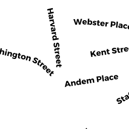
39 KENT ST 39-B
Owner Information
LINDSAY EMMA MULLEN & JAMES R
39 KENT ST #B
BROOKLINE, MA 02445


Property Details
39 KENT ST 39-B is classified as a Residential Condominium (Low-rise).
The primary structure on this property was built in 1855. There is 1120ft2 of residential/living space within this property. This property is listed as having 4 rooms.
39 KENT ST 39-B is valued at 634800. The land is valued at 0 and the structures are valued at 634800.
The most recent deed for 39 KENT ST 39-B is recorded at the local registrar in Book 37634, Page 217. 39 KENT ST 39-B was last sold on 2020-02-28 for 595000.
Assessment data from fiscal year 2021.
Flood Data
According to the FEMA National Flood Hazard Layer, this property does not appear to be in a flood zone. It may also be in an area not yet reviewed. Nonetheless, confirm this information prior to taking any action.
To view the flood hazards around this property, create a FEMA "Firmette" Map of the area around 39 KENT ST 39-B.
Broadband Internet Providers
| Provider | Type | Bandwidth (mbps) | |
|---|---|---|---|
| GCI Communication Corp. | Satellite | 0 | 0 |
| netBlazr Inc | Fixed Wireless | 50 | 50 |
| HughesNet | Satellite | 25 | 3 |
| Comcast | Cable | 1000 | 35 |
| VSAT Systems, LLC. | Satellite | 2 | 1 |
| XO Communications | Copper Wire | 0 | 0 |
| Starry, Inc. | Fixed Wireless | 200 | 200 |
| RCN | Cable | 500 | 20 |
| RCN | Cable | 1000 | 20 |
| Verizon New England Inc. | DSL | 15 | 1 |
| Viasat Inc | Satellite | 100 | 3 |
| Crown Castle Fiber | Fiber | 0 | 0 |
Broadband service provider data from December 2020.
Adjacent Properties
- 39 STATION ST
Two-Family Residential owned by MONTERO SEBASTIANA - 41 KENT ST A
Residential Condominium owned by WU ZHONGHAO - 41 KENT ST B
Residential Condominium owned by CHOW JENNIFER J - 25 31 KENT ST
Improved, Selectmen or City Council (Municipal) owned by TOWN OF BROOKLINE - 34 STATION ST R34-3
Residential Condominium owned by STILES JOSHUA - 31 STATION ST R31-1
Residential Condominium owned by CHURCHILL, TR MARY - 31 STATION ST R31-2
Residential Condominium owned by ELITSUR NOEET - 31 STATION ST R31-3
Residential Condominium owned by FENNEL JOYCE A - 31 STATION ST R31-4
Residential Condominium owned by WRIGHT MARIA D - 31 STATION ST R31-5
Residential Condominium owned by LINDER ELIZABETH P - 31 STATION ST R31-6
Residential Condominium owned by STEIN MARY LYNETTE - 32 STATION ST C-32
RTL-CONDO owned by CHURCHILL, TR MARY - 33 STATION ST C-33
RTL-CONDO owned by CHURCHILL, TR MARY - 34 STATION ST C-34
RTL-CONDO owned by MINIAS AMGAD - 34 STATION ST R-34
RTL-CONDO owned by MINIAS AMGAD - 34 STATION ST R34-1
Residential Condominium owned by SPEICHER MICHAEL & EMILY - 34 STATION ST R34-2
Residential Condominium owned by WINTER FRANCES J - 34 STATION ST R34-4
Residential Condominium owned by WEBSTER MARIA & ANNA G - 34 STATION ST R34-5
Residential Condominium owned by PAYNE THOMAS - 34 STATION ST R34-6
Residential Condominium owned by PAYNE THOMAS M - 30 STATION ST C-30
RTL-CONDO owned by DENNIS WEST LLC